
Reading the airspace above a point on the map
Long-press anywhere on the map and Vulture draws the airspace above that point as a vertical profile, with every ceiling, floor and frequency in the stack.

Airspace on a map is a flat problem drawn on a flat surface, and it hides the thing you actually need to know. Three outlines overlap the valley you want to cross. One starts at 1500 m, one at FL65, one goes from the ground up. Which of them matters depends on how high you will be when you get there, and the map cannot tell you that by drawing more outlines.
Vulture answers it by turning the question sideways.
Long-press a point
Press and hold anywhere on the map and the airspace sheet opens for that exact point. With a trackpad or mouse, a secondary click does the same thing. A marker stays behind on the map, so you can see which point the profile belongs to.
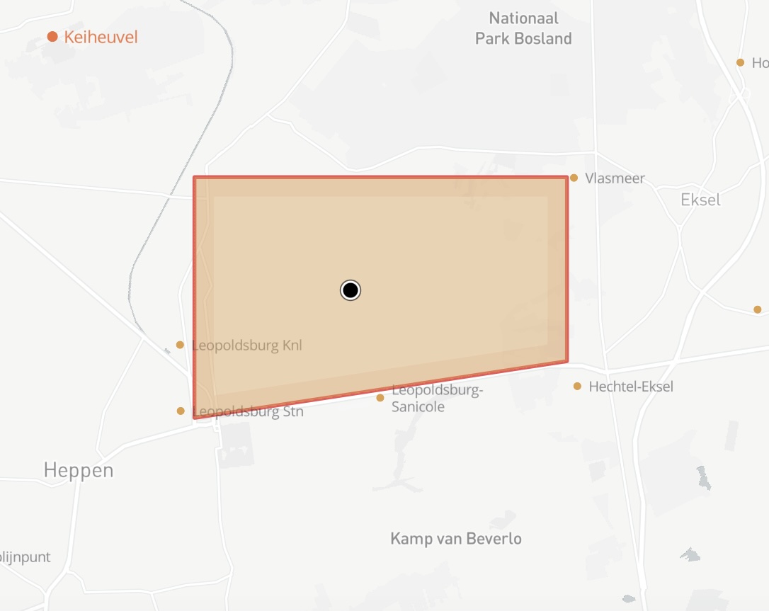
With the sheet up, the long press is no longer needed: a plain tap moves the query to a new point and the profile redraws for it. Working across a valley, tapping every few kilometres, is the quickest way to find where the floor steps up.
What comes up is not a list. It is a vertical profile of that point: one band per airspace, drawn from its floor to its ceiling, with the limits it was declared at down the left.
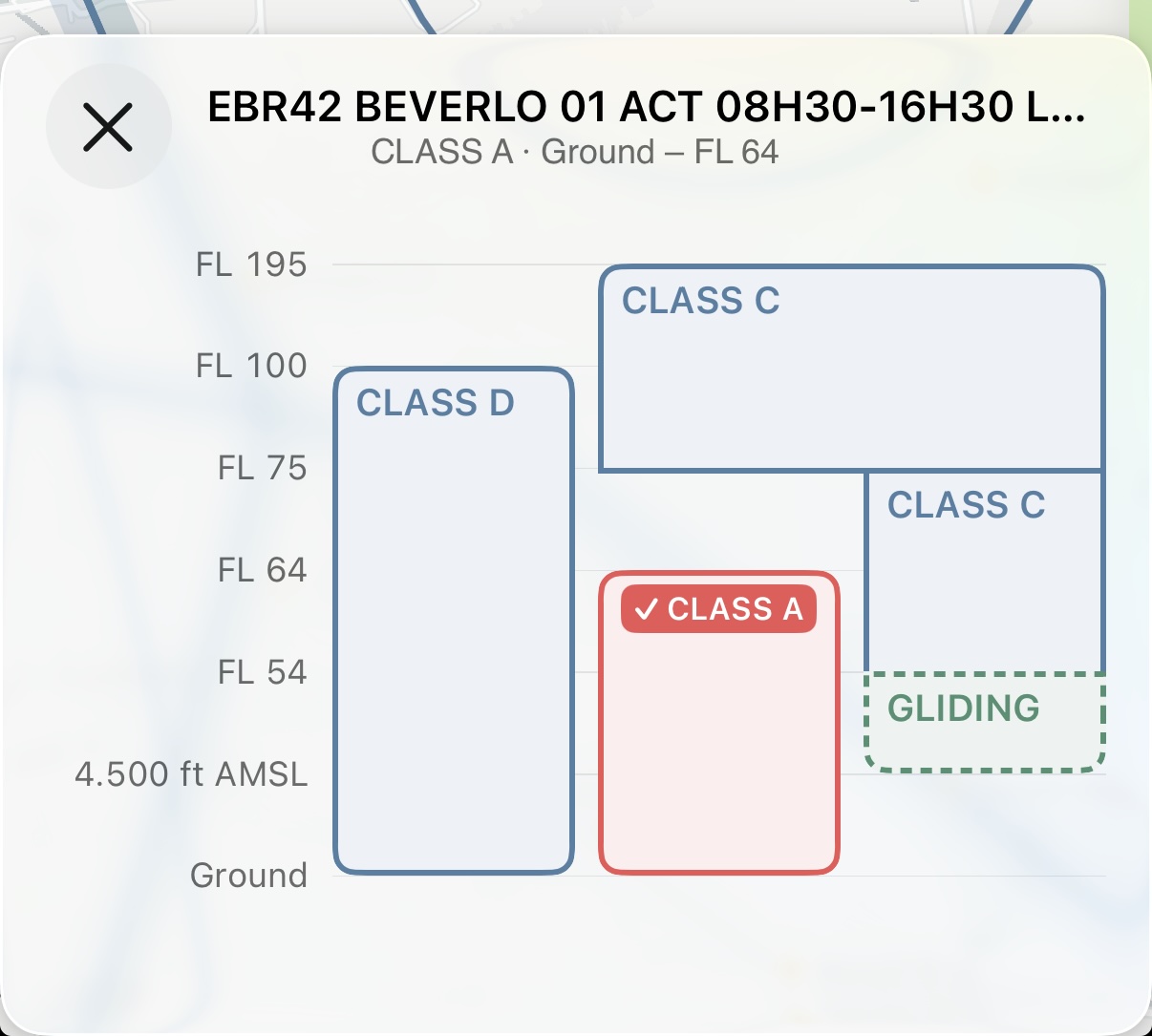
The layout follows the stack itself. Airspaces that overlap sit side by side in their own lanes, and each band widens into whatever lanes nothing else needs, so a name gets the width the stack can spare. Where nothing applies, there is a gap. Where one airspace's ceiling is another's floor, the two square off the edge they share and read as a single run.
The details
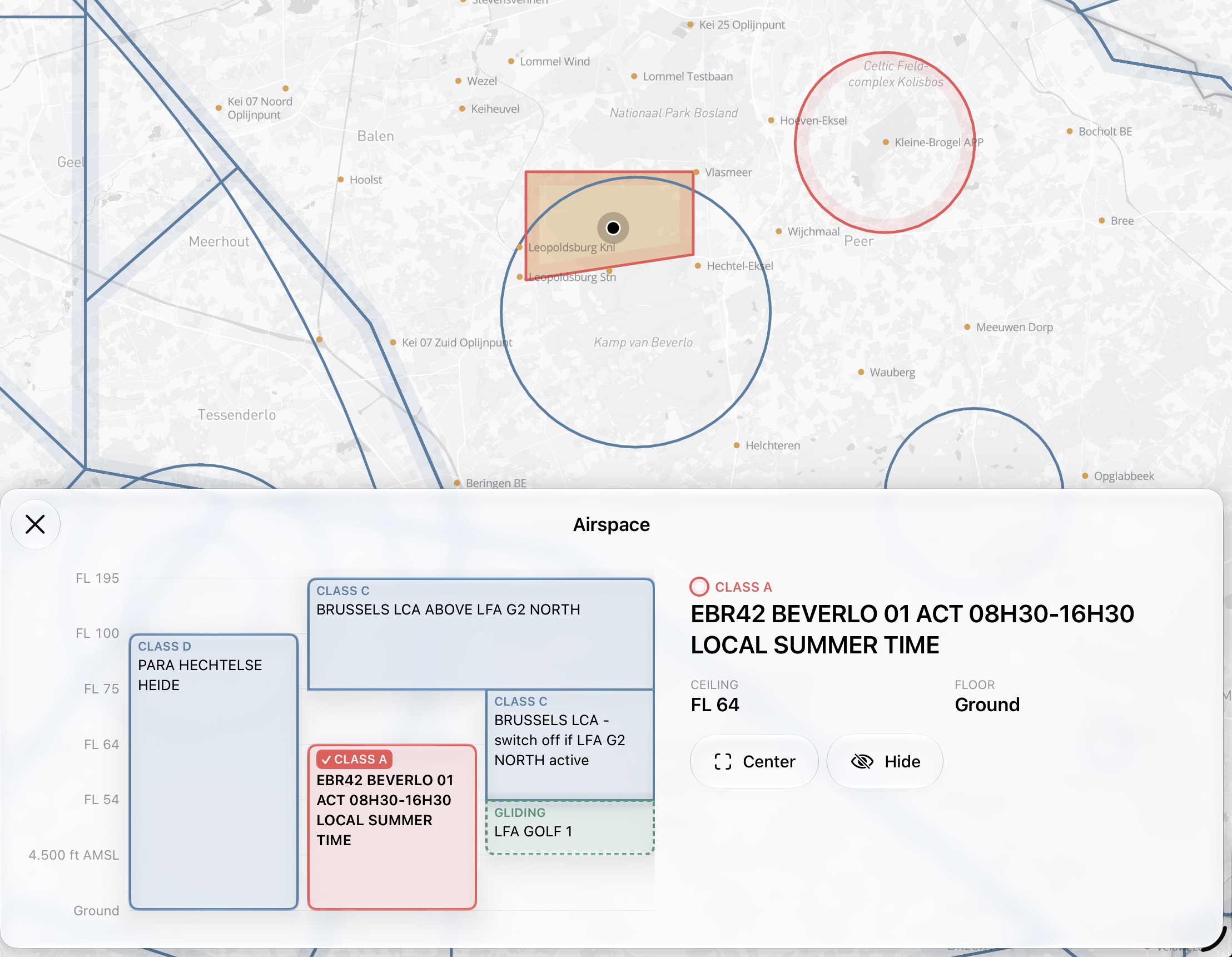
Tap a band and it highlights on the map, so you can see which outline you are reading. Its class label fills with the class colour and takes a checkmark — no colour enters the profile that the airspace does not already have on the map.
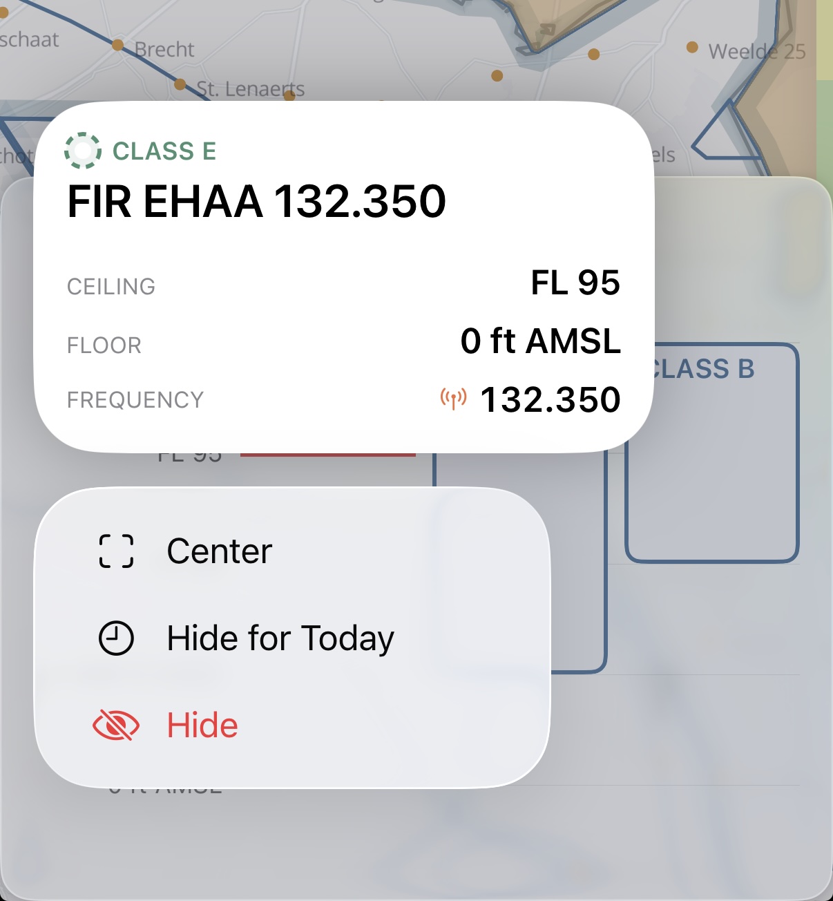
On an iPad the sheet is wide enough to keep a detail card beside the profile. The card carries the class, the name, the Ceiling, the Floor and, where the source declared one, the Frequency, with Center and Hide as buttons underneath. Hide is a menu, offering Hide for Today or Hide Always; three buttons in a row were cut to their first letter on a narrow sheet.
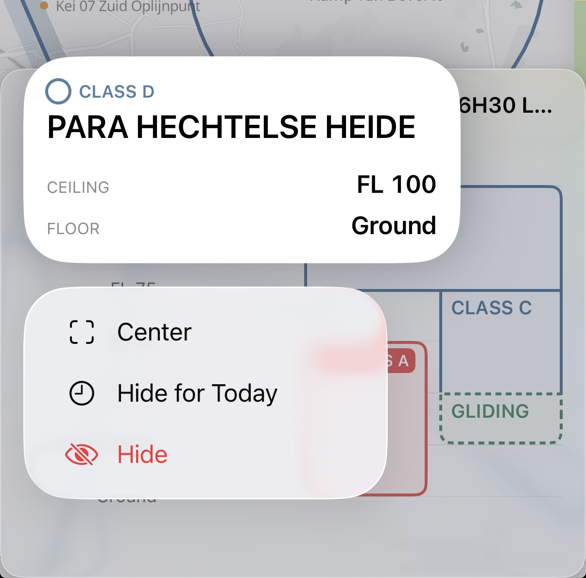
A phone has no room for that card, and the lanes there are too narrow for a name — in busy airspace it broke a letter at a time. So the sheet splits the job. A block carries its class alone, the navigation bar names whichever block you tapped with its class and limits underneath, and a long press on a block raises the rest — the name and the same Ceiling, Floor and Frequency the card would show — above its actions: Center, Hide for Today and Hide.
One limit: a cross-section needs horizontal room that the largest accessibility text sizes do not leave. Set one and the sheet gives up the profile and shows the stack as a list instead, one row per layer, carrying the same numbers.
Heights are shown as the source defines them, so they match the chart: AGL above the ground, AMSL above sea level, FL for flight levels, plus Ground and UNL for the two ends. No conversion is applied that the chart does not apply, because a converted number is a number you then have to convert back before you say it on the radio.
Vulture draws the classes it knows in the colours the ICAO VFR charts use: Class A through G, CTR, TMA, TMZ, RMZ and FIR, plus the ones that matter most to us — prohibited, restricted, danger, glider prohibited, gliding areas and wave windows.
In flight, with your altitude on it
The profile earns its keep in the air. On the in-flight map a dashed line is drawn across it at your current altitude, with the reading itself on a pill in the altitude column, and the band you are inside is flagged.
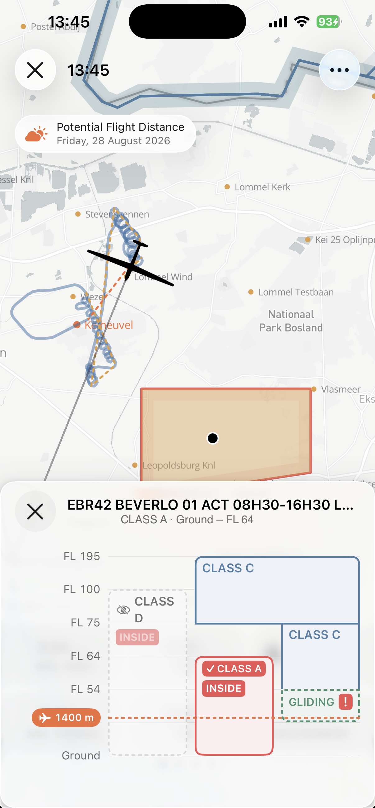
So the question stops being arithmetic. You are not subtracting your altitude from a ceiling while flying; you are looking at a line and seeing which side of it you are on, and how much room is left above you before the next base.
Recording a flight, and the in-flight map with it, is part of Vulture Pro. The profile itself is not: a long press on any map works on the free tier.
The marker is not only for the air. Open the sheet while analysing a flight and it follows the flight's current fix, so dragging the graph handle or running the replay moves it through the stack. The nearest band above and below the marker carry the vertical gap to it. The sheet also judges the glider laterally, not just by altitude: a fix outside an airspace's polygon is outside it whatever height it is at, and when the fix is over none of the listed airspaces the marker draws hollow.
Hiding what you do not need
Some airspace is permanently irrelevant to you, and some is irrelevant today. Both hides sit with the other actions — in the card's Hide menu, or under the long press on a phone: hiding a sector for good takes it off the map until you show it again, Hide for Today takes it off until tomorrow, when it comes back on its own.
That second one is for the sector that is active on paper but cold on the day. Hide it in the morning, fly without it cluttering the map, and it returns for the next flight without you having to remember to restore it.
Hiding works on the sectors of your own airspace files. The live openAIP layer is drawn as it comes, with nothing to hide in it.
Hidden airspace is genuinely hidden — it is filtered out before the map draws anything, so tapping where it used to be cannot bring it back. That is convenient right up to the moment you want it again. Turn on Show hidden sectors, under Map › Airspace in the settings, and Vulture looks hidden sectors up by coordinate instead: one at the point you tap is drawn in the profile as a greyed-out, dashed ghost band with an eye-slash before its class. You can read its details and show it again from there. The map still leaves it out either way.
The sidebar's Airspaces list has Hidden sectors in its menu, opening a list you can search. Its title is a menu: Hidden for what you have taken off the map, All zones for everything Vulture has loaded. Swipe a row to hide or show it. That is how you undo a hide you made months ago without hunting for the spot on the map where you made it.
To go through one file instead, tap the info button at the end of its row in the Airspaces list, or pick Show Sectors from its menu: every sector in the file with its class swatch, searchable, with the same swipe.
Where the airspace comes from
Two sources, and the map draws one of them at a time.
Your own files — CUB, OpenAir or openAIP — live in the sidebar's Airspaces list, as rows or as a gallery of cards with each file's sectors outlined on a map. Add them from Files or from the XCSoar repository with the list's add button, or drop them onto the list. A tap on a file takes it off the map or puts it back. With Automatic updates switched on under Map in the settings, Vulture picks up newer versions of the XCSoar files on its own when they appear.
Or let the map draw openAIP's live airspace, which streams as vector tiles instead of asking you to keep files current. A fresh install starts there, so the first map you see already has airspace on it. It needs a connection, which is the trade: files work in a valley with no signal, the live data is always current.
Custom Airspace, under Map › Airspace in the settings, switches between the two. While the map is on openAIP the Airspaces list says so in a notice over its rows, with a Use My Files button that switches back; the files stay listed and manageable either way.
Drawing your own files is part of Vulture Pro. Importing them is free, as is everything above: the openAIP layer, the profile and the infringement check are there on a fresh install without a subscription.
Both feed the same infringement detection. Vulture checks your track against whatever airspace is loaded and marks where you went through something you should not have, with markers on the map showing exactly where. The flight's detail popup lists the crossings as a row of its own directly under the flight, opening the list of crossings; a flight that crossed nothing shows no row, because an empty warning reads as a finding. One thing to know about that check: it runs against the airspace visible on the map, so pan or zoom out if you want to test a wider area.
From the keyboard
With a keyboard attached, the stack is drivable from the map. ↑ and ↓ step up and down it, and ⌥⌘A centres the map on whichever airspace is selected.
Happy flying, and blue skies!